Today's Meet - link1; link2; link3; link4; link 5
|
Follow the link to the Lewis and Clark route. Read the following passages:
Entry 1 - The Journey Begins Entry 4 - Racing Against Winter's Approach Entry 9 - Around the Great Falls Entry 12 - Deadly Crossing: The Bitterroots We are going to create a set of class notes based off of your entries to the Today's Meet link above. The notes will go into your notebook. It should go without saying that we should not see anything posted to this page that does not have to do with the classwork of the day. We will give you in class instructions on when to add your notes to the page. The format for your User Name needs follow - your grade depends on this: First Name and Partner's First Name, no nicknames... |
|
Lewis and Clark Sentence Stems
Entry 1 - The expedition had to keep ____________ watching because of ________________________________.
They followed the _____________________ at the beginning of their journey.
Entry 4 - The expedition protected themselves from winter by _______________________________.
The water in the river was so cold that ___________________________.
Entry 9 - The Great Falls caused the expedition to slow down because ______________________________.
The size of the Great Falls can be described as _______________________________________.
Entry 12 - Lewis and Clark used the ____________ River to ________________________________.
The Bitterroot Mountain Range can be described as ________________________________________.
Tuesday - January 26th, 2016 - Geographic Obstacles
The questions that are tied to the pictures should be able to be answered by thinking about (analyzing) the images and then discussing them with your group members. The four major geographic topics are: Mountains, Rivers, Plains, and Deserts.
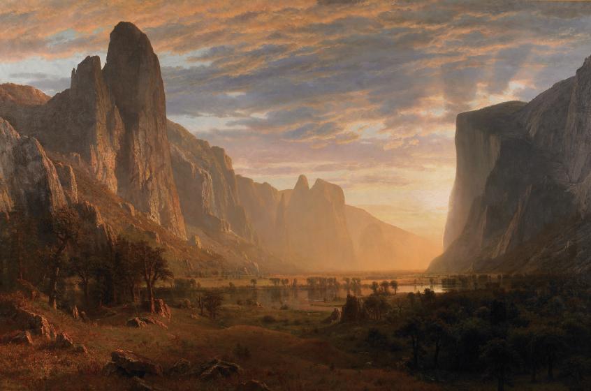
The Mountains
|
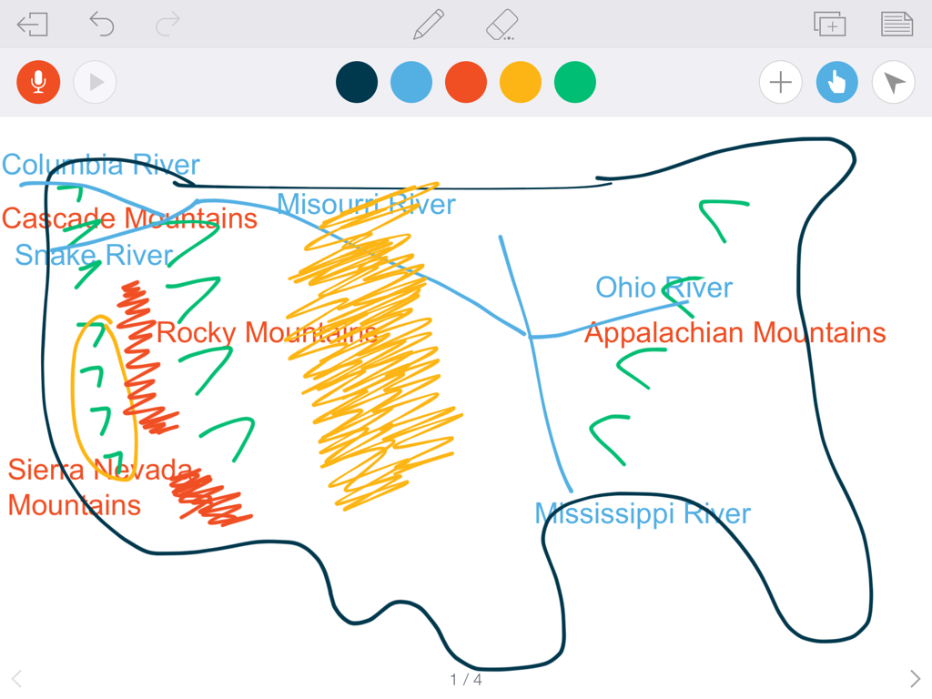
Located in the American West are a lot of mountain ranges. The three that are important in this part of history are the:
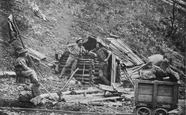
- Rocky Mountains - Sierra Nevada Mountains - Cascade Mountains The mountains are important for several reasons. One, they provided a significant barrier to immigrants looking to cross to the American West Coast. Two, there was gold discovered in the Sierra Nevada Mountains which caused tens of thousands of people to move to the land known as California. Look at the images in this section and use them to help answer the questions. Group conversations, teacher assistance, your textbook, and of course the internet are all sources that can help you. 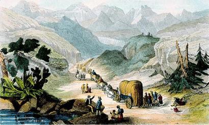
|
QUESTIONS:
How are the Rocky Mountains a barrier to the settlers moving west? How might the Rocky Mountains also keep settlers west once they had already moved west? What part did the Gold Rush play in people having to cross the Rocky Mountains? What mountain range did settlers look for gold in? How did this lead to the populating of California? What time of the year would settlers pass the Rocky Mountains? Why? Is there an alternative to crossing the Rocky Mountains? 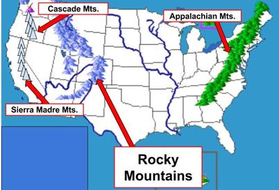
|
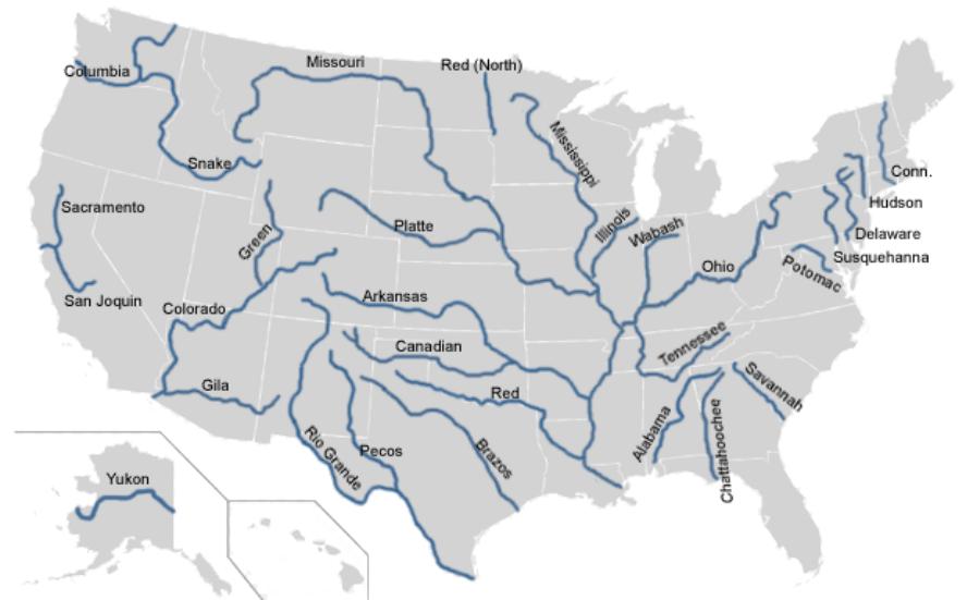
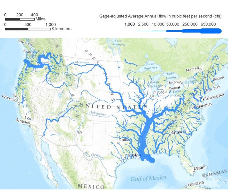
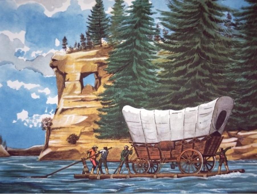
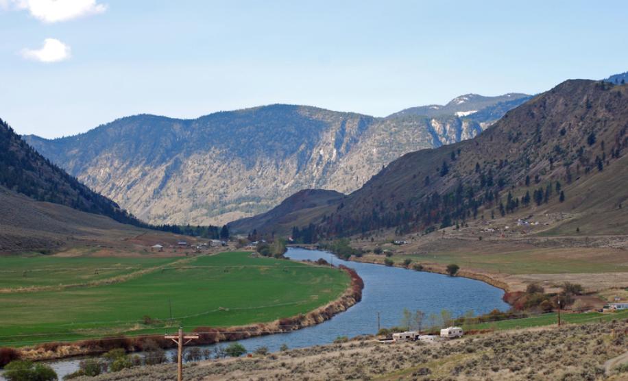
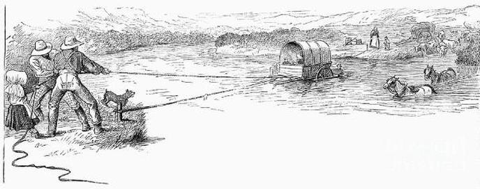
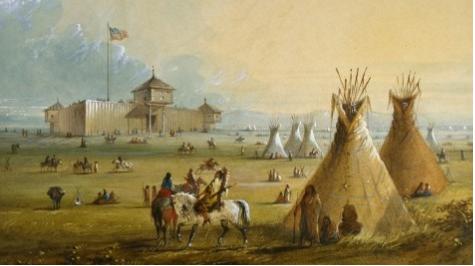
Rivers
Rivers were a valuable resource to settlers. They served as routes, transportation systems, and fresh water supplies. They also could become challenges to the settlers. Many of them were uncharted, deep, and contained rapids.
Look at the images here and use them to help you answer the questions. Group conversations, teacher assistance, your textbook, and of course the internet are all sources that can help you.
Look at the images here and use them to help you answer the questions. Group conversations, teacher assistance, your textbook, and of course the internet are all sources that can help you.
QUESTIONS:
How did rivers help guide settlers? Where do rivers originate? How could this help settlers find their way? How could rivers be dangerous for settlers? Why were forts located on the rivers? How were rivers a means of fuel supply for settlers and livestock? Name three major rivers that feed into the Mississippi River. Describe the map that has the "Average Annual flow".
|
|
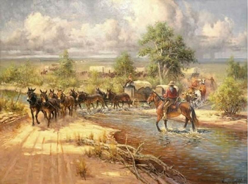
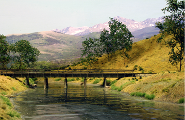
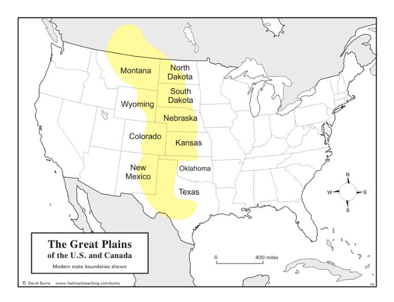
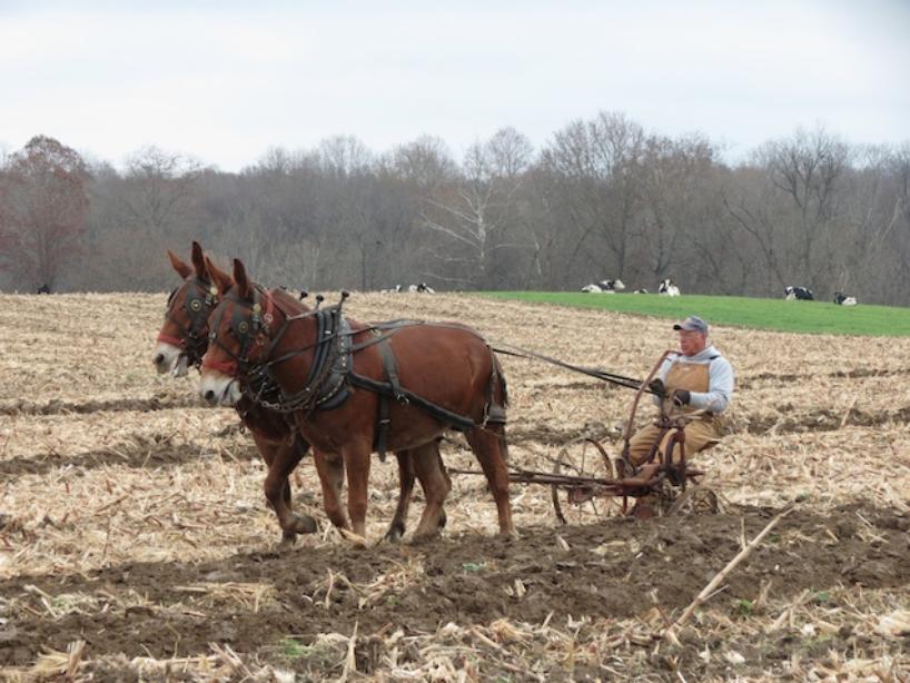
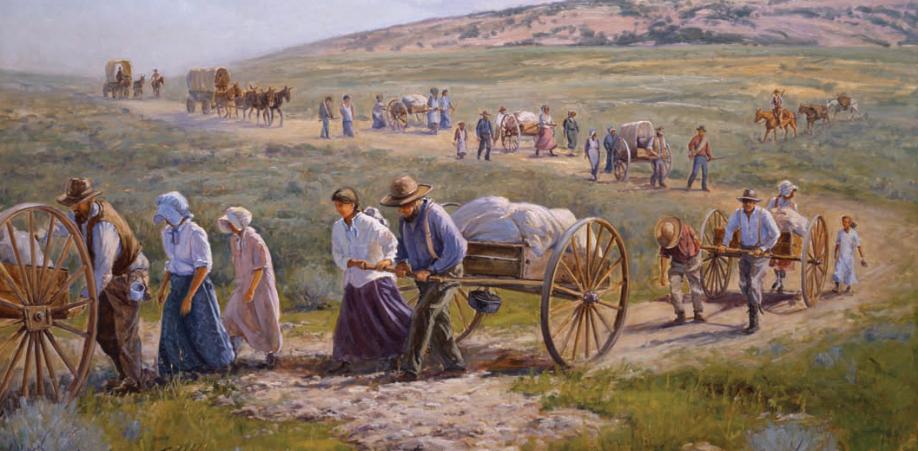
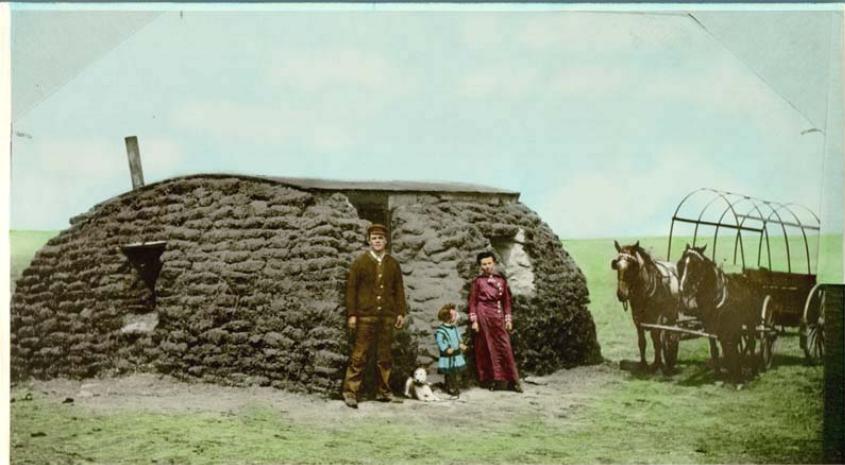
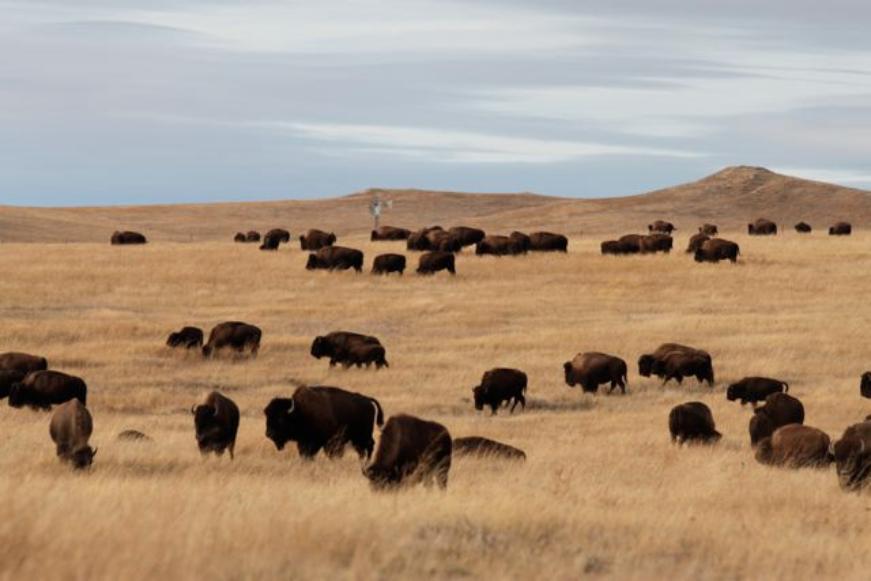
The Great Plains
Instructions: by now you should have the hang of what you are doing. Make sure to discuss with your partner the questions, they are not designed to be hard, just to make you think about the major geographic features of the settlers' journeys. Remember that your teachers are waiting for your hand to go up to have something to do besides update their status on Facebook and send out a few new Snapchats of their dogs.
|
QUESTIONS:
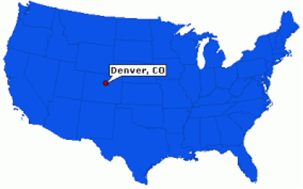
Generalize how big of a territory is the Great Plains region of the U.S. (what percentage)? How could the size of this region impact the settlers' journey? How did Mormon Carts add to the difficulty of traveling? Why do you think they didn't use horses or cattle? Why was the journey across the Great Plains a good example of the need to stop before the Rocky Mountains? Why else might settlers stop before crossing the Rocky Mountains? Hypothesize why Denver became such a large city. How might the picture below describe Denver, Colorado? 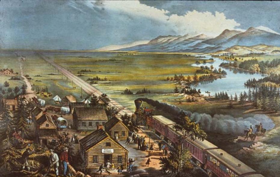
|
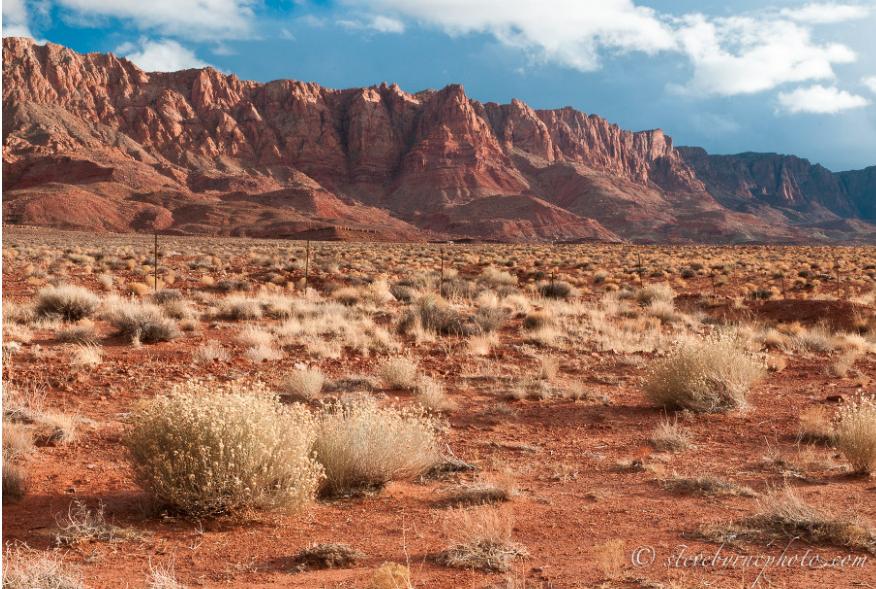
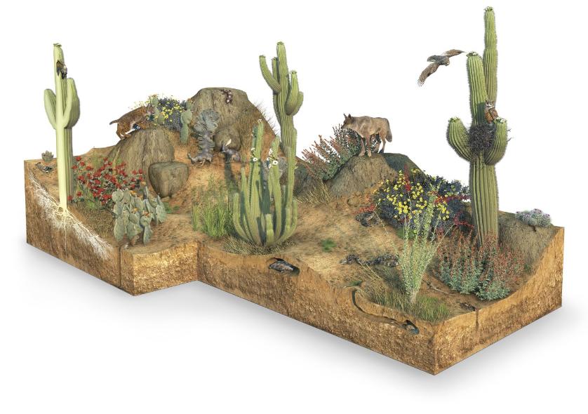
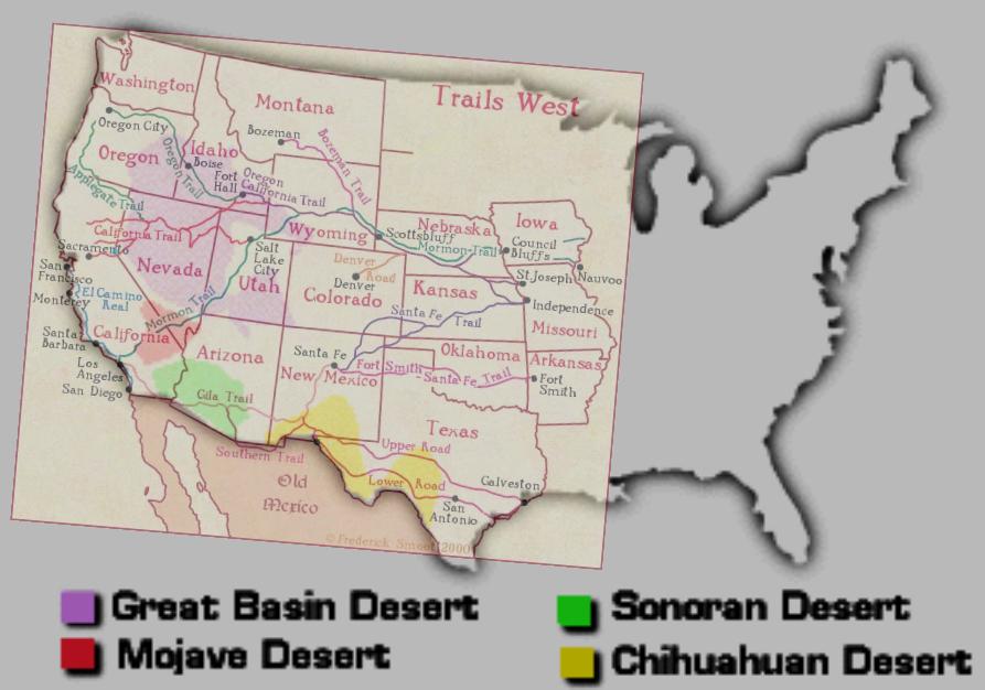
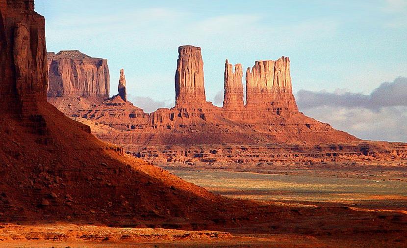
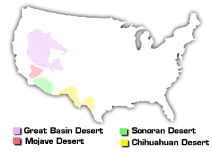
Deserts (not Desserts)
This is the fourth and last area we are looking at for geography. This area was a deterrent due to its obvious lack of water, extreme temperatures, and being south of where both the gold was being mined for and the Oregon Territory. Please read the questions below, discuss with your partner, and complete.
|
|
|
|
Questions:
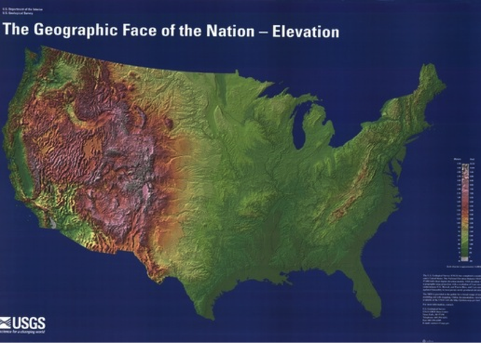
Why might someone consider taking the journey through the desert instead of going through the mountains? Describe what the desert ecosystem looks like. What dangers may exist in the desert for settlers? Look at the map that has the settler trails and the deserts. What conclusion(s) can you draw from these two merged maps? What conclusions can you draw from the map titled "The Geographic Face of the Nation - Elevation"? BONUS:The bottom left image for Deserts shows mountains that used to be under water. How did water shape them to look the way they did? |
|
|
|
Social, Economic and Political reasons for Manifest Destiny
|
Use the guide map to the right to label geographical features and trails of the USA in 1850.
|
| ||
| wednesdayjanuary21_1.pdf |
Homework: Take Cornell notes on Social, Economic, Political reasons for Manifest Destiny and summarize notes
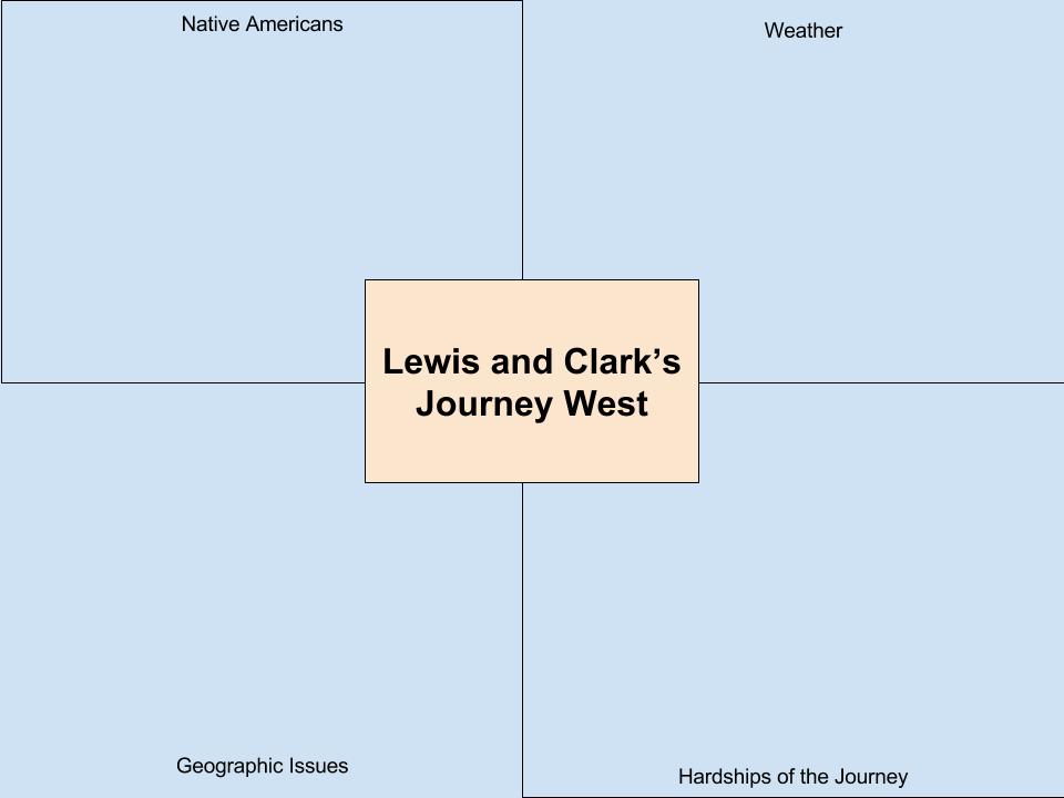
| geography_notes_organizer1_1.pdf |
Download and Print Geography Notes Organizer to take notes for this lesson.

Manifest Destiny
Topic: Geography
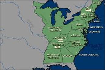
Warm Up: Let's review! What were the borders of the original 13 colonies?
Topic: Geography
Warm Up: Let's review! What were the borders of the original 13 colonies?
|
What were the borders of the US after the Treaty of Paris (after the Revolutionary War ended)?
|
|
|
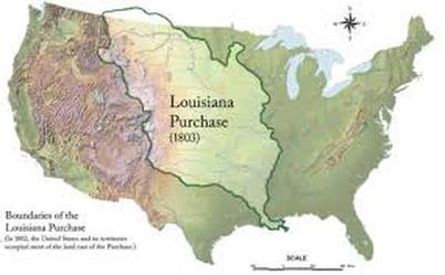
What were the borders of the US after the acquisition of the Louisiana Purchase of 1803?
Vocabulary Acquisition- to gain or acquire |
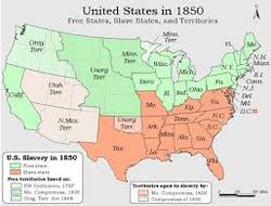
What were the borders of the US after the state adoption of California?
Adoption- official acceptance
Ok, let's get started! Let's begin by looking at the regions of the US.
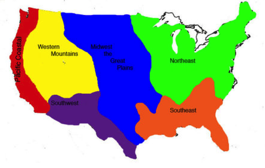
What region would you likely live in? Let’s explore!
If you were moving across America to settle somewhere in the west, what would you consider the most important?
Things you might consider:
If you were moving across America to settle somewhere in the west, what would you consider the most important?
Things you might consider:
- Work
- Housing
- Community
- Environment
- Time of travel
- Work
|
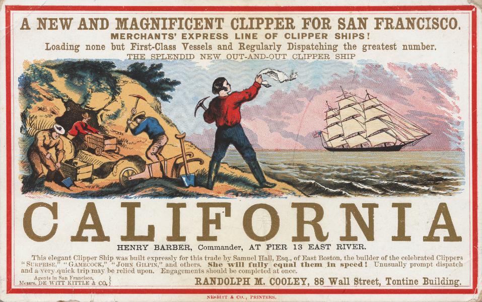
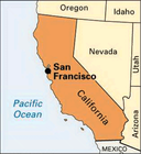
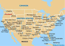
Popular Cities:
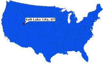
San Francisco, California: Located on the coast of the Pacific Ocean, Economy built around gold mining and a port, weather is similar to the Mediterranean climate of Greece or Italy (year round warm days and cool nights) Portland, Oregon: Located in the Pacific Northwest, on the Columbia River connecting it to the Pacific Ocean, Economy was built around fur trapping, logging, and trading. Weather features warm, dry summers compared to cool, wet winters. Denver, Colorado: Located on the edge of the Rocky Mountains, it was the last stop for travelers moving west to stop city before crossing steep Rocky mountains. Economy: Trading post Weather is mild summers, and cold snowy winters. Salt Lake City, Utah: Located in the heart of three mountain ranges, Salt Lake City was founded for religious freedom for the Mormons in a secluded area. Weather is hot, dry summers and cold, wet winters. |
Mountain Ranges in the US
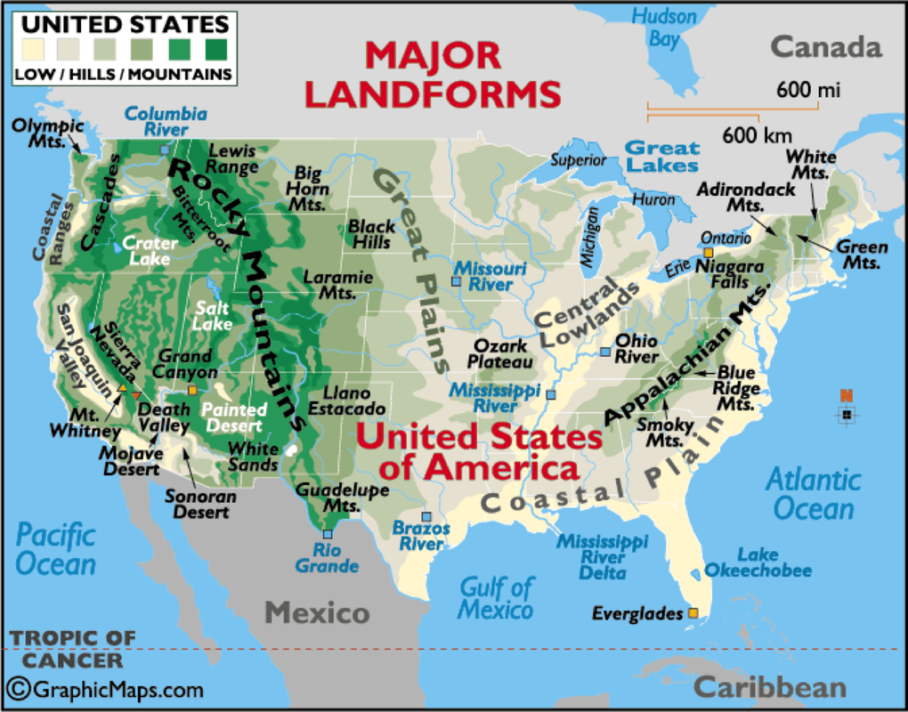
The mountain range on the east coast is _____________________.
The mountain range in the northwest is _____________________.
The mountain range along the west coast is _____________________.
The mountain range in the west is _______________________.
The mountain range in the northwest is _____________________.
The mountain range along the west coast is _____________________.
The mountain range in the west is _______________________.
What American mountain range is the highest?
Compare the mountain ranges of the west to the Appalachian mountains of the east.
Compare the mountain ranges of the west to the Appalachian mountains of the east.
Other US Geological Features

Why do you suppose grasslands are in the center of the US?
Why are the deserts located in the Southwest US?
Why are the deserts located in the Southwest US?
American Rivers

Infer what the most important river to the US is. Estimate how long it is.
What is the main river in the Pacific Northwest?
What is the main river in the Pacific Northwest?
